|
YARP
Yet Another Robot Platform
|

|
|
YARP
Yet Another Robot Platform
|
|
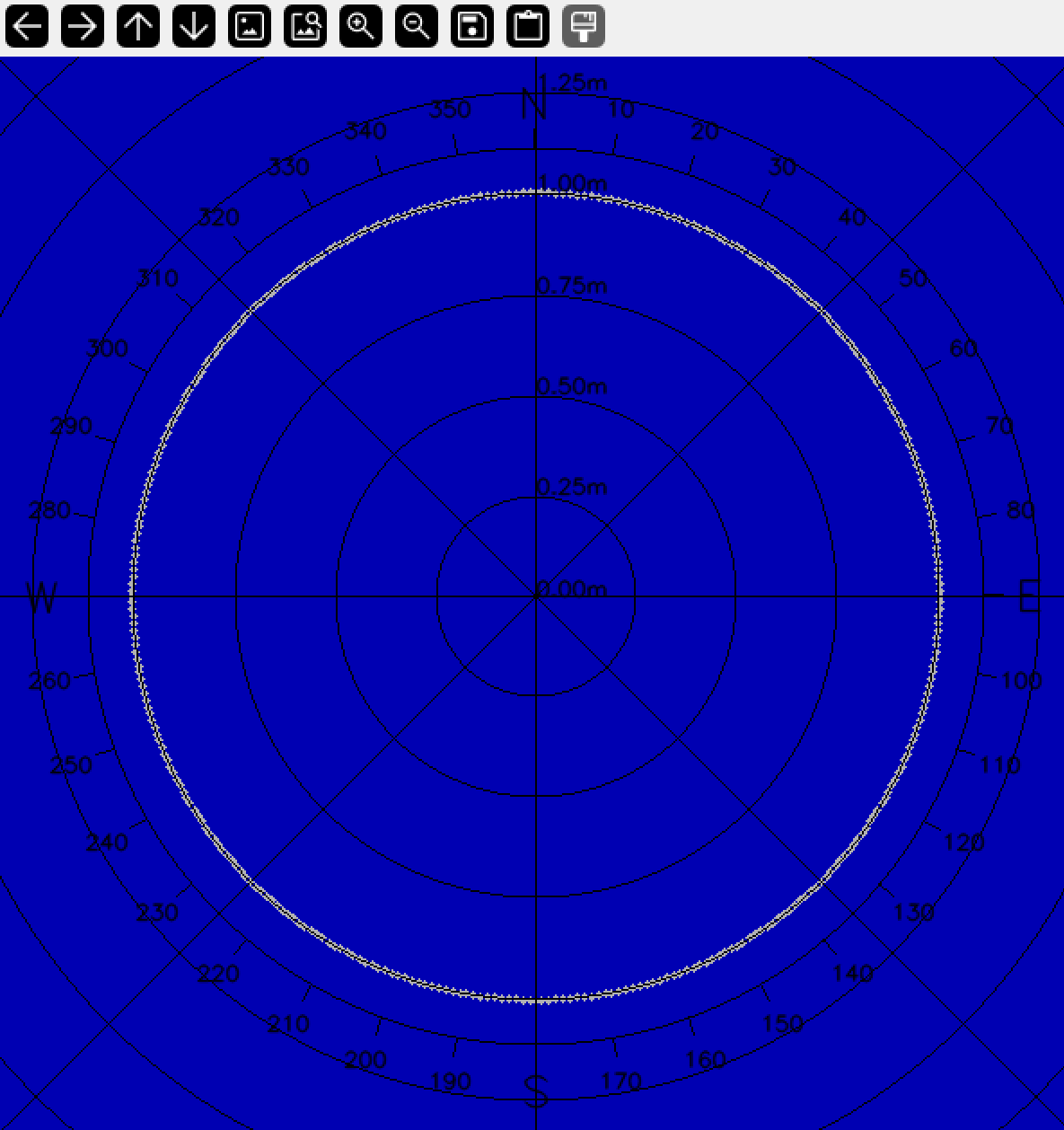
A simple GUI to display the distance measurements of a 2D laser scanner.
 Collaboration diagram for yarplaserscannergui: visualize data from a laser scanner:
A simple GUI to display the distance measurements of a 2D laser scanner.
The gui display lidar measurements ( yarp::sig::LaserMeasurementData) on a polar diagram.
--scale <double>            zoom factor (default 100)
--robot_radius <double>     the radius of the displayed robot footprint
--sens_position_x <double>  the position in meters of the laser center respect to the center of the robot (default 0 m)
--sens_position_y <double>  the position in meters of the laser center respect to the center of the robot (default 0 m)
--sens_position_theta <double> the orientation in degrees of the laser sensor respect to the center of the robot (default 0 deg)
--verbose <bool>            toggles debug messages on/off (default false)
--absolute <bool>           display the laser in absolute o relative mode (default false)
--compass <bool>            displays the compass (default true)
--period <double>           the refresh period (default 50 ms)
--aspect <0/1>              draws line/points (default 0=lines)
--sens_port <string>        the name of the port used by rangefinder2D_nwc_yarp to connect to the laser device. (mandatory)
--carrier <string>          the name of the carrier used by rangefinder2D_nwc_yarp for connection to the server
--lidar_debug               shows NaN values
--local <string>            the prefix for the client port. By default /laserScannerGui. Useful in case of multiple instances.
Available commands (pressing the key during execution):
c ...... enables/disables compass.
a ...... set absolute/relative mode.
w ...... zoom in.
s ...... zoom out.
v ...... set verbose mode on/off.
r ...... set refresh period (50/100/200ms).
b ...... change aspect (lines/points)
The gui uses as Rangefinder2D_nwc_yarp device to connect to a Rangefinder2D_nws_yarp and receive data.
None.
None.
None.